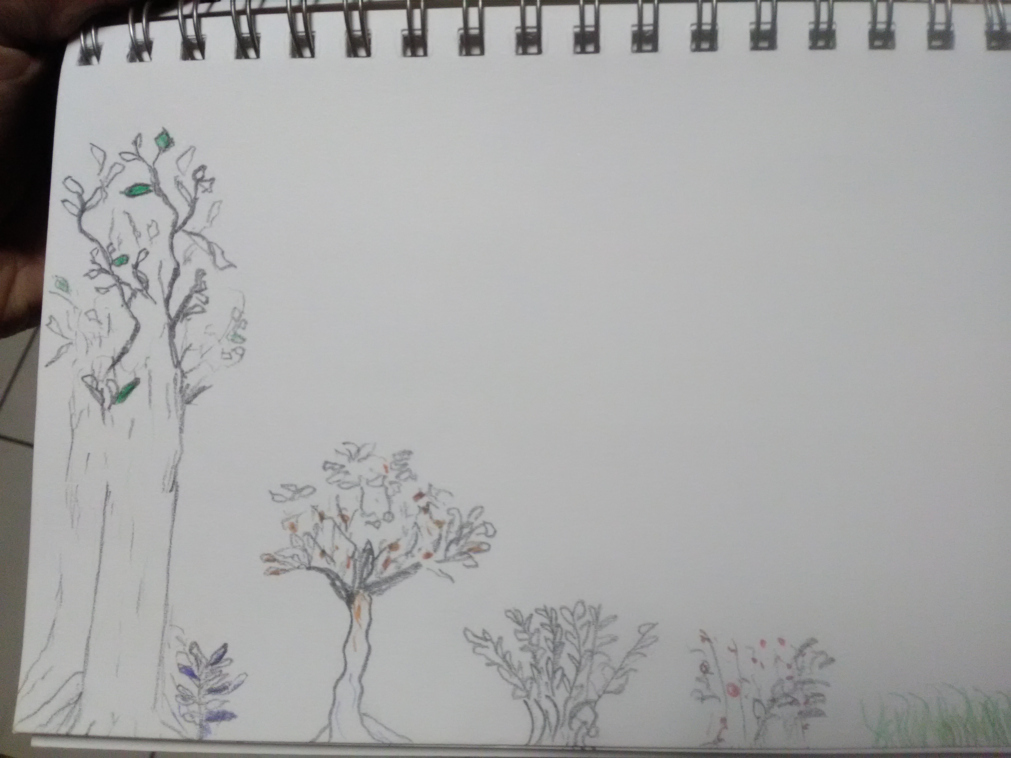
something slightly (slightly) more developed
Nov 9, 2019 20:32:47 GMT -5
The Semi-Retired Gamer and The Perilous Dreamer like this
Post by hengest on Nov 9, 2019 20:32:47 GMT -5
Breaking with weeks of tradition here at Evening Bell, I have something slightly different here.
These images represent parts of an area, once developed and lived in, now abandoned. The images show what was, perhaps 100-120 years before present. You might have them deteriorate differently for your campaign, so I am going to present them as they are and then mention my own thoughts on how it all collapses.
In the lower left, we have undeveloped forest, the edge of which, grading slowly down into meadow, has been used as a forest edge garden. This garden area is labelled as such on the overmap. On the forest edge map, which I largely stole but re-drew (poorly) from a book on forest edge gardening, you can see roughly how it works: shade-tolerant herbs are planted under the tall trees, while outside the forest proper, there are rows of useful plants in decreasing height and decreasing shade tolerance:
At the time, the interactions between these different setting provided many micro-environments and contributed to what we would call biological diversity. Paths between these "levels" provided access to all the plants and were used socially. These paths graded into in-wood paths, well-trodden by mushroom hunters.
A well-trodden, less grassy area narrows into a path that leads towards the central area on the map. At first, heading toward that central area, one will pass by several paths branching to the left and right, by which one can walk alongside relatively narrow strips of berry and herb gardens. Heading straight and not diverging to the left or right, you come to the central area, paved with stone and containing two semi-circular internal gardens of fruit trees. Stairs lead down from the area to an artificial pond surrounded by large stones. To the left of this pond on the map is the village proper, crudely represented here.
To the right of the pond is an item that is not actually located here, but is included in this image because I drew it here. Set into the ground, it appears to be a gigantic single gemstone with veins of blues and reds throughout, and an alteration of color in its center which, viewed from a hill a ways away or from above, give it almost the appearance of a stylized eye. One cannot see through the colored stone, although we would say it has the appearance (roughly) of extremely thick stained glass. If there is anything in a chamber underneath, it cannot be glimpsed from above.
Overmap here:


These images represent parts of an area, once developed and lived in, now abandoned. The images show what was, perhaps 100-120 years before present. You might have them deteriorate differently for your campaign, so I am going to present them as they are and then mention my own thoughts on how it all collapses.
In the lower left, we have undeveloped forest, the edge of which, grading slowly down into meadow, has been used as a forest edge garden. This garden area is labelled as such on the overmap. On the forest edge map, which I largely stole but re-drew (poorly) from a book on forest edge gardening, you can see roughly how it works: shade-tolerant herbs are planted under the tall trees, while outside the forest proper, there are rows of useful plants in decreasing height and decreasing shade tolerance:
- first, some small fruit or nut trees
- hazelnut
- berry bushes
- Jerusalem artichoke (in-world called sunchoke)
- meadow
At the time, the interactions between these different setting provided many micro-environments and contributed to what we would call biological diversity. Paths between these "levels" provided access to all the plants and were used socially. These paths graded into in-wood paths, well-trodden by mushroom hunters.
A well-trodden, less grassy area narrows into a path that leads towards the central area on the map. At first, heading toward that central area, one will pass by several paths branching to the left and right, by which one can walk alongside relatively narrow strips of berry and herb gardens. Heading straight and not diverging to the left or right, you come to the central area, paved with stone and containing two semi-circular internal gardens of fruit trees. Stairs lead down from the area to an artificial pond surrounded by large stones. To the left of this pond on the map is the village proper, crudely represented here.
To the right of the pond is an item that is not actually located here, but is included in this image because I drew it here. Set into the ground, it appears to be a gigantic single gemstone with veins of blues and reds throughout, and an alteration of color in its center which, viewed from a hill a ways away or from above, give it almost the appearance of a stylized eye. One cannot see through the colored stone, although we would say it has the appearance (roughly) of extremely thick stained glass. If there is anything in a chamber underneath, it cannot be glimpsed from above.
Overmap here:


